Overview
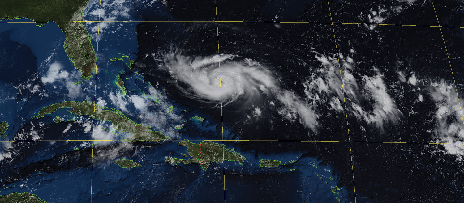
Visible image with Blue Marble mask showing Hurricane Dorian on August 30th, 2018
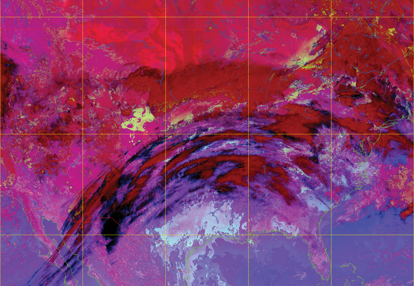
Night Microphysics RGB product created using iDAP
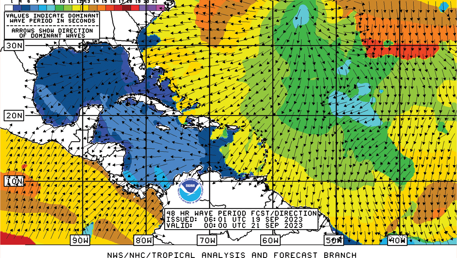
National Weather Service (NWS) wave forecast chart
Reliable, high-performance system for receiving and processing HRIT images, NWS charts, EMWIN products and other data from GOES geostationary satellites.
The Dartcom GOES HRIT System can receive, archive, process and display images, charts and other data from the National Oceanic and Atmospheric Administration (NOAA) Geostationary Operational Environmental Satellite (GOES) satellite series.
The hardware comprises a 1.25m parabolic dish antenna with an integrated feed/downconverter and a Dartcom USB LRIT receiver.
GOES L-Band direct broadcast data includes HRIT images, National Weather Service (NWS) charts and Emergency Managers Weather Information Network (EMWIN) products.
Images and charts can be viewed and processed using the Dartcom iDAP software, with facilities such as animation, enhancement, RGB products, palette products, reprojection, masking, printing and exporting to third-party file formats.
The Dartcom MacroPro software automates the processing facilities provided by iDAP, enabling fully automatic ingest and processing with full logging and alarms.
Outputs are also available for processing software such as PCI Geomatica, ERDAS IMAGINE and ENVI/IDL, as well as standard interchange formats such as PGM and GeoTIFF.
Geostationary Ingester Software
Dartcom also offers EUMETCast, HimawariCast, GK-2A LRIT and GK-2A UHRIT systems.