Software Upgrades
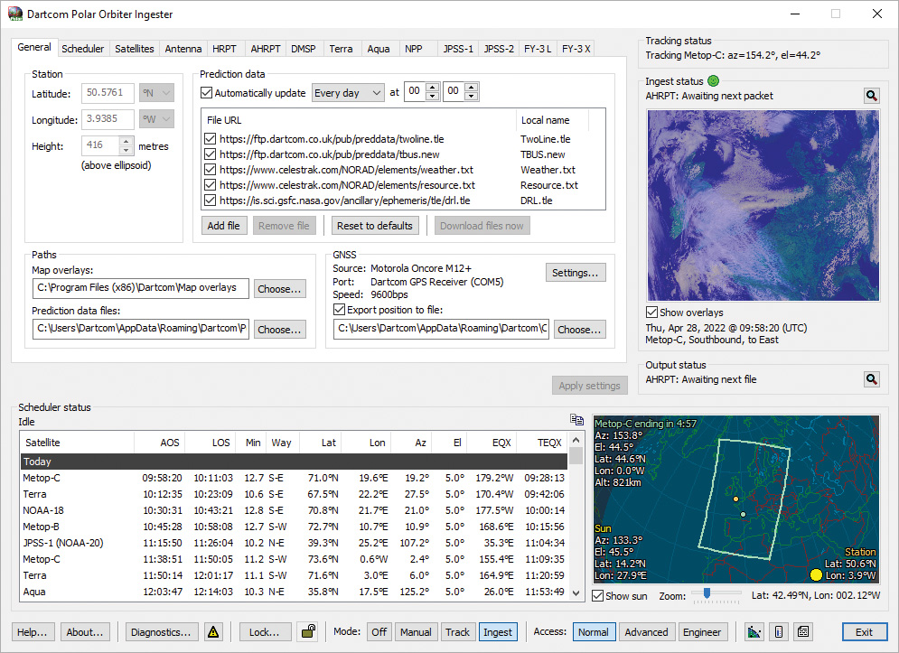
Dartcom Polar Orbiter Ingester software
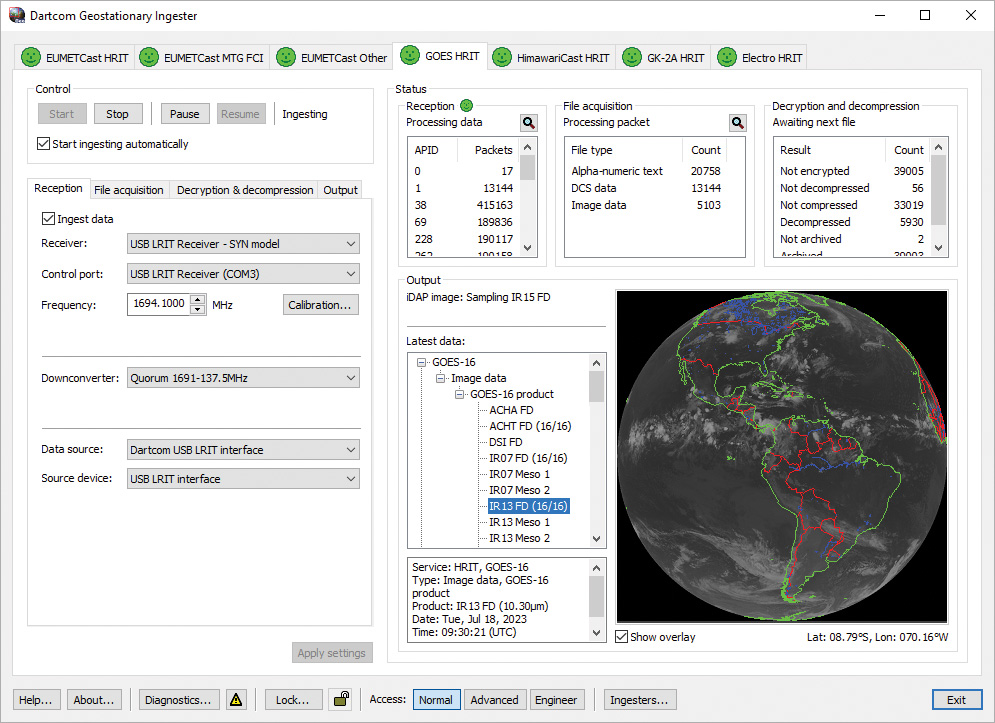
Dartcom Geostationary Ingester software
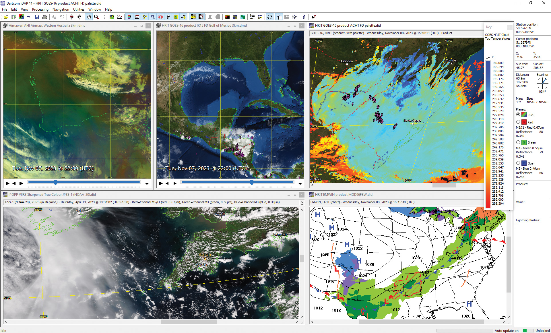
Dartcom iDAP/MacroPro software
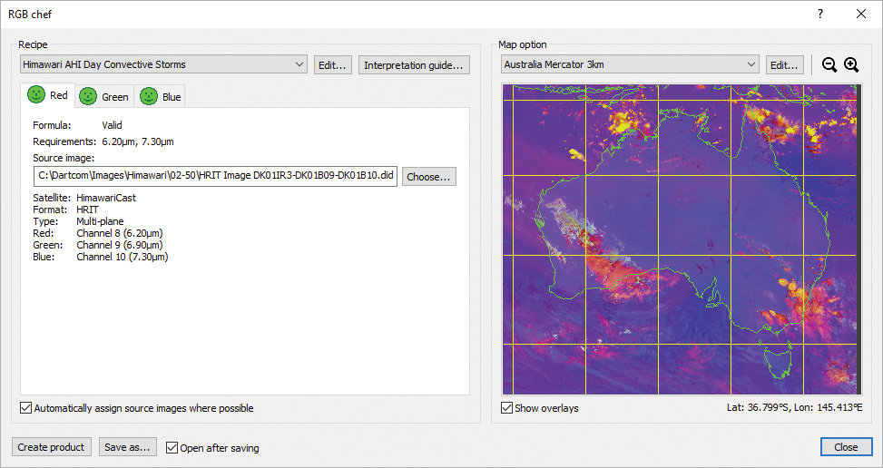
RGB product creation facility with a Convective Storms product
Macro folders, automatic naming and improved organisation
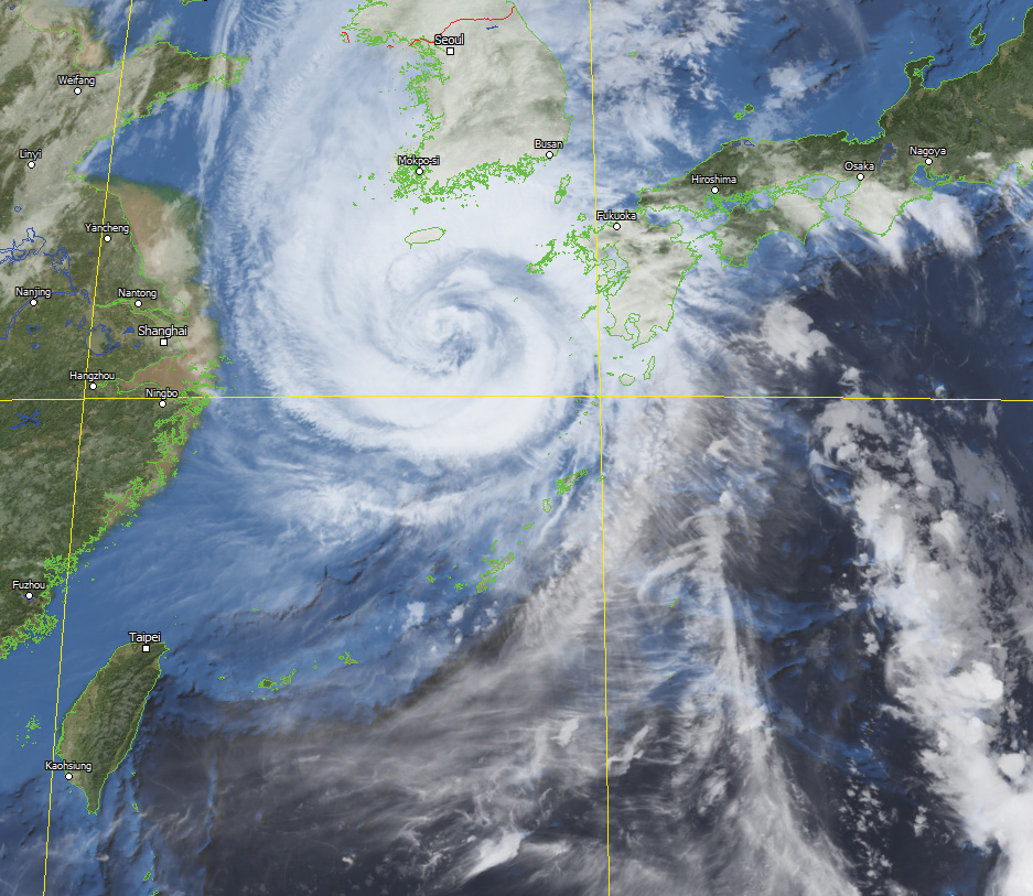
GK-2A infra-red image with screen blended Blue Marble mask
Upgrade your Dartcom software to the latest versions and enjoy the benefits of new and improved features, with a year of free updates and technical support.
At Dartcom we continuously develop our software to improve it, add new features and fix issues. If your Dartcom system no longer qualifies for free software updates, read on to discover what you’re missing.
Software upgrades include the latest software versions and a year of free updates and technical support. The updates are provided on our Downloads page. Support is available via email and telephone, with remote access included.
Some recent software enhancements are described below.
General enhancements
- Compatible with Windows 10 and 11. 64-bit versions only. 32-bit versions and earlier versions of Windows no longer supported.
- Support for EUMETCast MTG and GOES ABI level 1b NetCDF data, GEO-KOMPSAT-2A (GK-2A) LRIT/HRIT/UHRIT, Metop-C, FengYun-3E and JPSS-2 (compatible reception hardware required).
- Support for GOES GLM and MTG LI lightning data.
- Specially developed image file format allowing huge image sizes and vastly reduced memory usage. Existing images are converted automatically when opened.
- Improved navigation accuracy for Metop AHRPT images.
- Right-click (or context) menus are provided in various places.
- Window sizes and positions are remembered between sessions.
iDAP/MacroPro enhancements
- Many processing functions use worker threads to speed them up by splitting the task across multiple processor cores. Compared to previous single thread versions, reprojection and Blue Marble masking are up to 3 times faster, DEM masking up to 6 times faster and palette product creation up to 7 times faster.
- Manual and automatic creation of RGB products such as Airmass, Ash, Cloud Phase, Convection, Dust, Fires, Fog, Microphysics, Snow, Sulphur Dioxide, Water Vapour and blended images, from MTG, MSG, GOES, Himawari, GK-2A and NOAA/Metop data.
- Manual and automatic GeoTIFF import and archiving allowing images produced by the NASA IPOPP software to be used in iDAP.
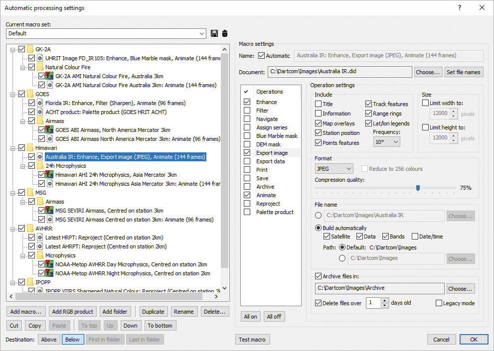
- Automatic processing macros can be named automatically, organised into folders, duplicated, and copied or moved within or between macro sets. Macros for processing reprojected images and products can be added with one click.
- The MacroPro tray icon shows when processing is in progress and a tooltip shows the current processing operation.
- Automatic processing runs can be interrupted and cancelled.
- MacroPro has logging and alarms for diagnostics.
- The time interval between automatic update and processing runs can be reduced as low as 5 seconds, with an alert sound.
- Tools are provided to ease working on multiple displays.
- Image enhancement includes gamma correction and image planes can be adjusted simultaneously or individually.
- The image and data export facilities include GeoTIFF format and automatic file naming options.
- Images and map options can be automatically centred on the current station position – ideal for moving vessels.
- Cursor mode allows a “sticky” cursor to be dropped on an image.
- Specially developed animation system allowing fast updates.
- Animation frame details are overlaid at a configurable position and stay at a constant size as the animation is resized.
- Multiple animations can be played synchronised by time allowing different bands, areas or products to be compared easily.
- The palette product creation function allows logarithmic scales, up to 256 colours, and import and export.
- The Blue Marble and DEM masking functions have a screen blending mode that effortlessly extracts cloud.
- Reference points have been replaced by features and series. Features are lists of points, and a series is a group of features that can be applied to all images, or an image can have its own series.
- Track features can be created, with lines between points.
- Range rings can be added to feature points and the station marker. This allows approximate distances to be gauged “Radar”style.
- Points and lines from Google Earth KML/KMZ files and ESRI Shapefiles can be imported into features and map overlays.
- GSHHG map overlays and 1 minute resolution DEM data set.
- Lightning flash overlays and lightning density products.
More information
For prices, how to order, or if you have any questions about the software upgrades, please contact us.
Geostationary Ingester software