iDAP/MacroPro Software  Overview
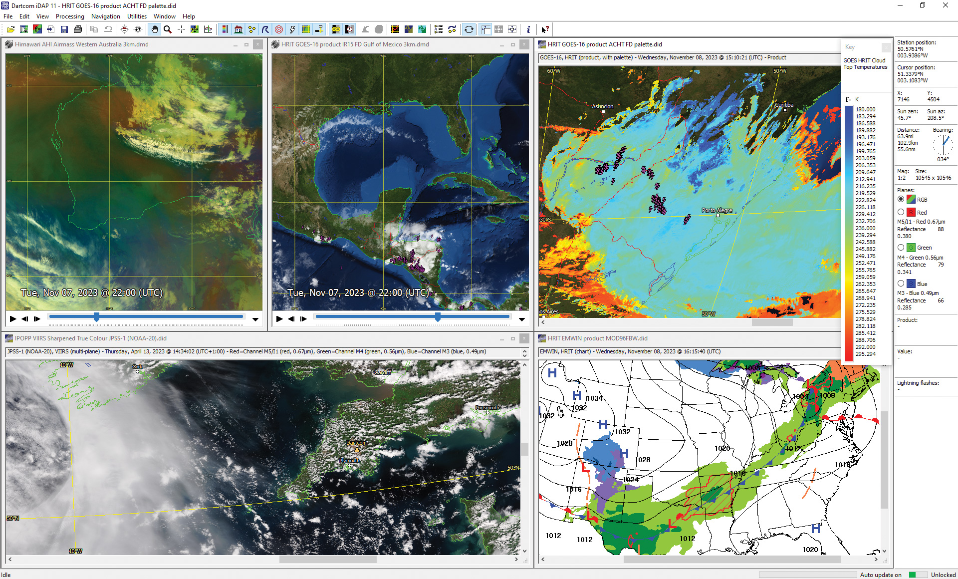
Dartcom iDAP software
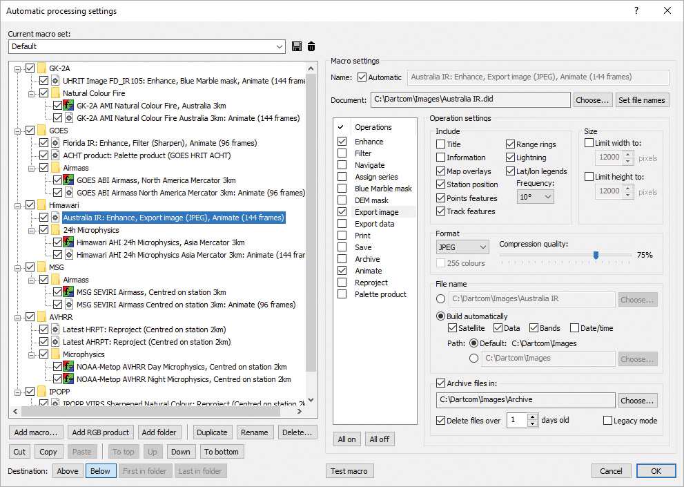
Dartcom MacroPro automatic processing setup window
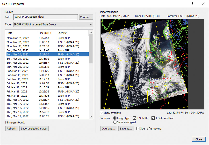
GeoTIFF importer window
Integrated display and processing software for satellite imagery and meteorological data with automatic importer and macro processor.
The Dartcom iDAP software allows images, charts, products and animations produced by Dartcom ingest systems to be displayed and processed in one unified program. MacroPro automates the powerful import, processing and output facilities provided by iDAP.
iDAP includes a wide range of professional yet easy-to-use facilities for displaying, processing, printing and exporting satellite imagery, meteorological charts and products.
Dartcom’s own purpose-built image and animation technologies efficiently support huge image sizes and smooth, high-quality animations with fast updates and editing facilities.
MacroPro allows processing macros to be run on images, charts and products automatically when new data is ingested or imported.
Key features of iDAP and MacroPro include:
- Handling of HRPT, AHRPT, DMSP, Terra, Aqua, Suomi NPP, JPSS, FY-3, MTG FCI/LI, GOES ABI, LRIT, HRIT and UHRIT data.
- Multiple animations with time-synchronised playback.
- Automatic updating of open windows as new data is received.
- Worker threads utilising multiple CPU cores for faster processing.
- RGB products such as Airmass, Ash, Convection, Dust, Microphysics, True Colour and Natural Colour using band mathematics.
- Palette products such as cloud height, rainfall rate, SST, NDSI, NDVI and lightning density, with built-in formula language.
- Reprojection of images to map projections such as Mercator, Equirectangular and Polar Stereographic, with mosaic facility.
- Blue Marble and DEM masking with blending, tinting and slicing.
- Map overlays and vector features such as points of interest and storm or vessel tracks, with labels and range rings.
- Markers showing lightning flashes and wind speed and direction.
- Exporting to JPEG, PNG, BMP, TIFF, CSV, PCI Geomatica, ERDAS IMAGINE, ENVI/IDL, GeoTIFF, EPS level 0 and NOAA level 1B.