iDAP/MacroPro Software  Polar Orbiter Features
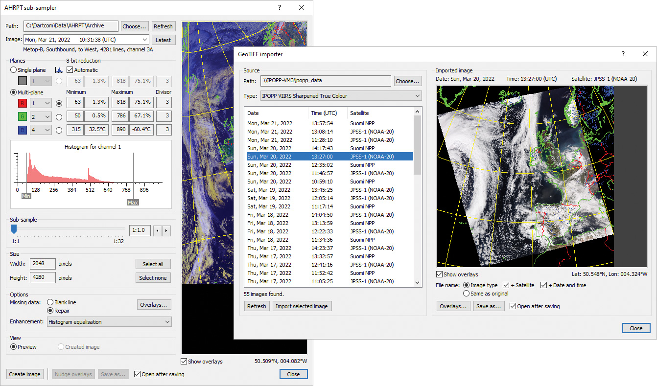
AHRPT sub-sampler window and GeoTIFF importer window
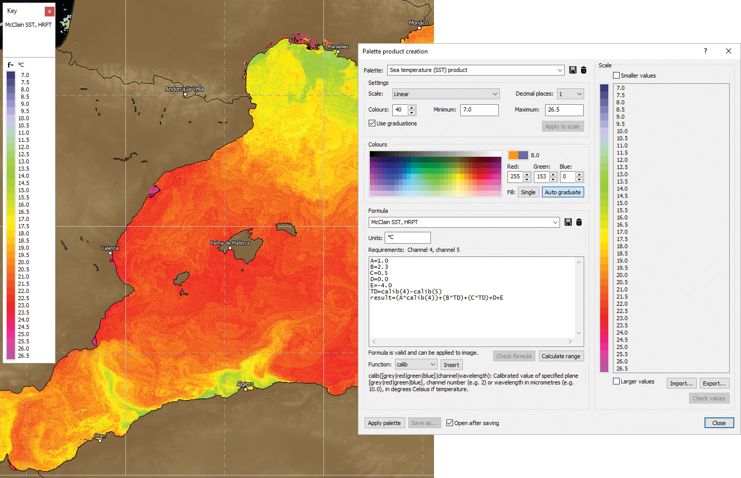
SST product with DEM mask obscuring land and palette product creation window set up for an SST product
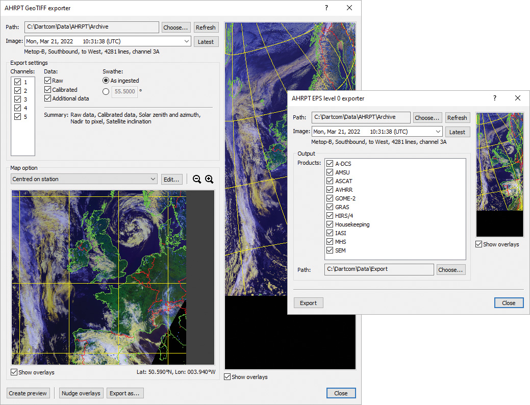
GeoTIFF exporter and EPS level 0 exporter windows
Importing
- Importing of raw HRPT data in Dundee standard, Quorum standard and legacy Dartcom HRPT/CHRPT Grabber formats.
- Importing of raw AHRPT data in Dundee standard format.
- Configurable satellites database for raw import.
- Manual and automatic importing of GeoTIFF images produced by CSPP, IMAPP, IPOPP and CMA FY-3 processing software, with product browser, file naming options, map overlays and archiving.
Sub-sampling
- Sub-sampling of HRPT, AHRPT and DMSP data to produce calibrated, navigated iDAP images.
- Single plane or multi-plane (false colour) images.
- Area selection with latitude/longitude read-outs to assist.
- Automatic or manual 8-bit reduction parameters with statistical analysis, histograms and calibrated read-outs to assist.
- Image enhancement with adjustable profile.
- Navigation and creation of map overlays and grid lines.
- Repair of missing image lines.
- Overlay nudge facility to correct any minor navigation errors due to out-of-date prediction data or satellite attitude errors.
- Adjustable satellite swathe angle.
- Editing of calibration parameters with import and export.
Processing
- RGB products such as Cloud, Microphysics, Blended Visible/Infra-red and Blended False Colour/Infra-red.
- Palette products such as SST, NDSI and NDVI.
- Reprojection of satellite swathe (as ingested) to map projections such as Mercator and Polar Stereographic, with mosaic facility.
Exporting
- Exporting of raw and calibrated HRPT, AHRPT and DMSP data to PCI Geomatica, ERDAS IMAGINE, ENVI/IDL and GeoTIFF formats, reprojected and with solar zenith and azimuth, nadir to pixel and satellite inclination layers.
- Exporting of raw AHRPT data to standard EPS level 0 format, with product filtering.
- Exporting of raw HRPT data to standard NOAA level 1B format, with packing, byte order and file naming options.
- Exporting of raw HRPT data to other raw formats including standard raw and HRPT level 0, with header, byte order, and file naming options.
- Exporting of ancillary HRPT data, including NORAD two-line elements, TBUS data, DCS and TIP, with file naming options.