Major new Dartcom software updates released
Posted in Software Upgrades July 31st, 2019 at 9:54 am by Chris Wright
Dartcom is pleased to announce major new upgrades to all of its software. The updates are available on our Downloads page and are free if your Dartcom system is within its 2 year initial support period, or you have an active support agreement.
Highlights of the new software are as follows:
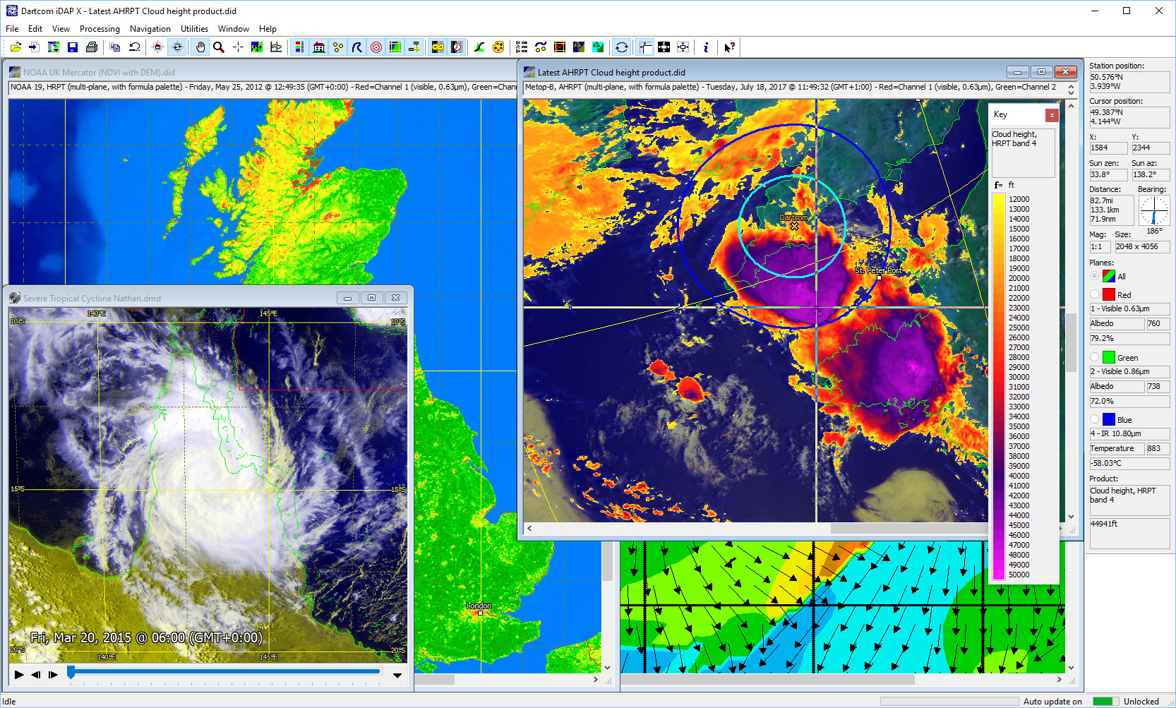
iDAP/MacroPro
- Unlimited image size, faster load times and more efficient memory usage thanks to a new purpose-built image format developed specially by Dartcom.
- Manual and automatic import of X-Band EOS GeoTIFF images produced by the NASA IPOPP software, with quick and easy archive browsing.
- Full diagnostics facilities in MacroPro, including logging, alarms and storage monitoring.
- Images and reprojections can now automatically re-centre on the current station position – ideal for moving vessels.
- Significant performance improvements for Blue Marble and DEM masking, plus and a new Screen blending mode for easy cloud extraction.
- Upgraded formula palettes with up to 256 colours, logarithmic scale support and import/export facilities.
- Support for multiple displays with tools to make arranging windows to fill displays easy.
- Time-synchronised playback of multiple animations.
- Creation of vector line features such as storm tracks with CSV and Google Earth KML/KMZ import.
- Range rings around feature points and the station position to give a radar-style indication of distance.
XRIT Ingester
- New GEO-KOMPSAT-2A (GK-2A) LRIT and HRIT ingesters to support the new services that have replaced COMS LRIT and HRIT.
- Support for GOES ABI level 2+ products available on the GOES HRIT service.
- Support for NWC and GOES ABI level 1b netCDF data available on EUMETCast SAF.
Polar Orbiter Ingester
- Projected outputs can now automatically re-centre on the current station position – ideal for moving vessels.
- Support for the FY-3D and JPSS-2 X-Band satellites.
- Support for the Metop-C L-Band satellite.
Full details of all the software features will shortly be available in the Products section of the website.